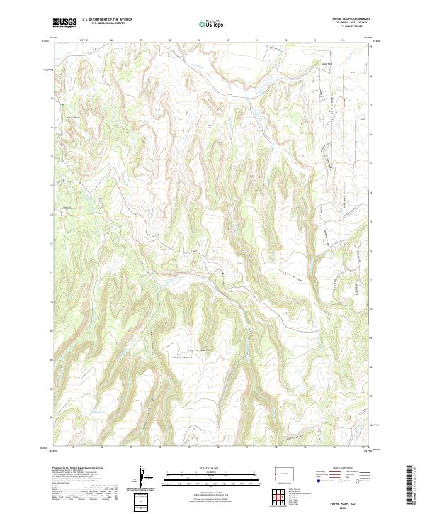
2022 Map of Payne Wash
USGS Topo · Published 2022About this map
Glade Park sits at the northern edge of this high-desert landscape, where the plateau is deeply incised by complex drainage systems and canyons. The Little Dolores River and Payne Wash cut through the central terrain, defining the local topography alongside prominent features like Payne Mesa and Piñon Mesa. This area is characterized by a network of ranch roads and access routes, such as Masters Ranch Dr and Red CreekRanch Rd, which indicate the enduring agricultural and pastoral use of the land in Mesa County. Significant landmarks including Miracle Rock and the remote Maiden Spring are documented alongside named geographic cuts like Jefferson Canyon and Tommy Dodson Canyon. The presence of Lane Reservoir and smaller tributaries like Dierich Cr and McGinley Cr highlights the vital role of water management in this arid environment, showing the connection between the high ridges of Timber Ridge and the deep canyon floors.
Find a feature on this map
43 named features on this map. Tap any name to fly to it.
Don’t see what you’re looking for? This feature index may not catch every label — zoom into the map to look around manually.
Map Details
Editions of this 2022 Payne Wash Map
This is the sole edition of this map. No revisions or reprints were ever made.
Other maps of this area

1934 · Colorado National Monument
USGS Topo · 1:24,000

1956 · Moab
USGS Topo · 1:250,000

1956 · Grand Junction
USGS Topo · 1:250,000

1959 · Grand Junction
USGS Topo · 1:250,000

1959 · Moab
USGS Topo · 1:250,000

1960 · Moab
USGS Topo · 1:250,000

1960 · Grand Junction
USGS Topo · 1:250,000

1962 · Moab
USGS Topo · 1:250,000

1962 · Grand Junction
USGS Topo · 1:250,000

1962 · Colorado National Monument
USGS Topo · 1:24,000