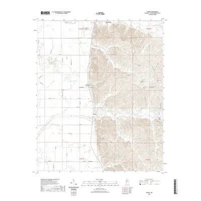
2020 Map of Paynes
USGS Topo · Published 2020About this map
The community of Paynes sits at the heart of this landscape where the flat alluvial plains meet the rising hills of Tallahatchie County. This topography is defined by the complex drainage of Ascalmore Creek and Hubbard Creek, which carve through the elevated terrain east of the Delta. The transition from the lowlands near Charleston to the ridges is marked by a series of family and community landmarks, including Magnolia Cemetery and Rowland Cemetery. To the north, the Charleston Municipal Airport provides a modern utility near the winding path of Tillatoba Creek. Further south, the settlement of Leverett anchors the corner of the survey near Jackson Creek. The density of rural churches, such as Adams Arbor Church of God Prophecy, reflects a deeply rooted social structure tied to the land and its local watercourses like Lake Tallaha and Young Creek.
Find a feature on this map
69 named features on this map. Tap any name to fly to it.
Don’t see what you’re looking for? This feature index may not catch every label — zoom into the map to look around manually.
Map Details
Editions of this 2020 Paynes Map
This is the sole edition of this map. No revisions or reprints were ever made.
Other maps of this area

1932 · Philipp
USGS Topo · 1:48,000

1935 · Crowder
USGS Topo · 1:62,500

1935 · Philipp
USGS Topo · 1:62,500

1939 · Crowder
USGS Topo · 1:62,500

1939 · Philipp
USGS Topo · 1:62,500

1948 · Helena
USGS Topo · 1:250,000

1950 · Helena
USGS Topo · 1:250,000

1953 · Greenwood
USGS Topo · 1:250,000

1953 · West Point
USGS Topo · 1:250,000

1954 · Grenada
USGS Topo · 1:62,500