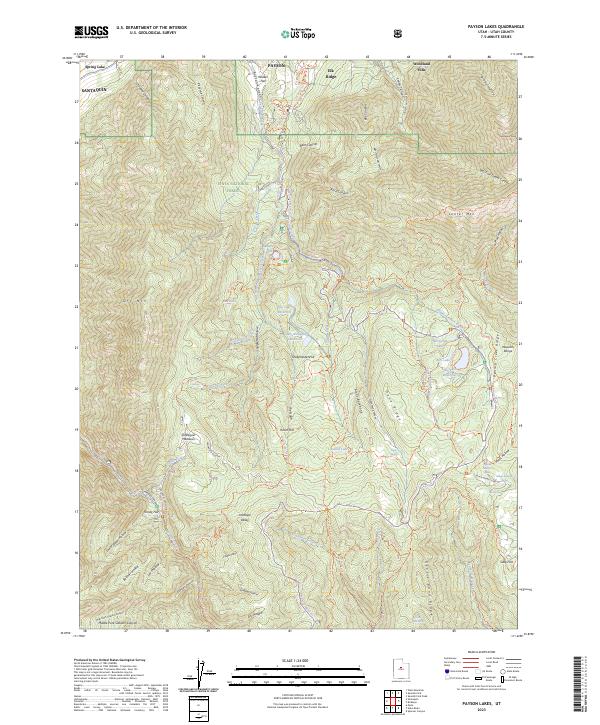
2023 Map of Payson Lakes
USGS Topo · Published 2023About this map
Uinta National Forest dominates this mountain landscape south of Payson, where high ridges and deep canyons define the transition from the valley floor to the Mount Nebo Wilderness. The map documents a complex network of canyons, including Santaquin Canyon and Loafer Canyon, which serve as primary drainages for the surrounding peaks. Water management and recreational sites are central to the area's layout, evidenced by high-elevation water bodies like Big East Reservoir, Pete Winward Reservoir, and Maple Lake. Cultural and residential expansion is visible at the northern margin in Elk Ridge and Woodland Hills, while the southern reaches remain largely primitive, characterized by named cattle-grazing and sheep-herding landmarks like Kuntz Flat and the Sheepherder Hill Trl. A legacy of pioneer-era named springs, such as Minnie Simmons Spring and Dipping Corral Spring, highlights the historical importance of water sources in this high-desert environment.
Find a feature on this map
83 named features on this map. Tap any name to fly to it.
Don’t see what you’re looking for? This feature index may not catch every label — zoom into the map to look around manually.
Map Details
Editions of this 2023 Payson Lakes Map
This is the sole edition of this map. No revisions or reprints were ever made.
Other maps of this area

1885 · Salt Lake
USGS Topo · 1:250,000

1885 · Manti
USGS Topo · 1:250,000

1895 · Manti
USGS Topo · 1:250,000

1948 · Spanish Fork
USGS Topo · 1:24,000

1949 · Provo
USGS Topo · 1:62,500

1949 · Spanish Fork Peak
USGS Topo · 1:24,000

1950 · Spanish Fork
USGS Topo · 1:24,000

1950 · West Mountain
USGS Topo · 1:24,000
1950 · West Mountain
USGS Topo · 1:62,500

1951 · Spanish Fork Peak
USGS Topo · 1:24,000