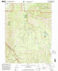
1998 Map of Payson Lakes
USGS Topo · Published 2002About this map
Mount Nebo and the southern reaches of the Wasatch Range define this landscape, where the Uinta National Forest provides a backdrop for high-elevation recreation and resource management. The map details a network of campgrounds including Payson Lakes Campground, Tinney Flat Campground, and Blackhawk Campground, all connected by the Nebo Loop Scenic Byway. This corridor transitions from the agricultural valley near Spring Lake into steep canyons like Bear Canyon and Picayune Canyon.
Find a feature on this map
90 named features on this map. Tap any name to fly to it.
Don’t see what you’re looking for? This feature index may not catch every label — zoom into the map to look around manually.
Map Details
Editions of this 1998 Payson Lakes Map
This is the sole edition of this map. No revisions or reprints were ever made.
Other maps of this area

1885 · Salt Lake
USGS Topo · 1:250,000

1885 · Manti
USGS Topo · 1:250,000

1895 · Manti
USGS Topo · 1:250,000

1948 · Spanish Fork
USGS Topo · 1:24,000

1949 · Provo
USGS Topo · 1:62,500

1949 · Spanish Fork Peak
USGS Topo · 1:24,000

1950 · Spanish Fork
USGS Topo · 1:24,000

1950 · West Mountain
USGS Topo · 1:24,000
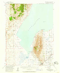
1950 · West Mountain
USGS Topo · 1:62,500

1951 · Spanish Fork Peak
USGS Topo · 1:24,000