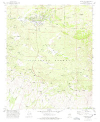
1973 Map of Payson South
USGS Topo · Published 1975About this map
Payson serves as the focal point of this 1970s study, revealing the community's footprint just as it was beginning to expand into the surrounding Tonto National Forest. The map documents critical local infrastructure and heritage sites, including the Payson Cem, the High Sch, and the historic Ft McDonald (Ruins) located in Green Valley. Beyond the town limits, the landscape is defined by its mining legacy, with several named operations such as the Silver King Mine, Golden Wonder Mine, and Oxbow Mine dotting the drainages of Oxbow Gulch and Lousy Gulch. The delineation of the Payson Indian Reservation adjacent to the town and the extensive network of cattle tanks and springs, like American Tank and Peach Orchard Spring, illustrate a working landscape where ranching, resource extraction, and early residential growth converged.
Find a feature on this map
114 named features on this map. Tap any name to fly to it.
Don’t see what you’re looking for? This feature index may not catch every label — zoom into the map to look around manually.
Map Details
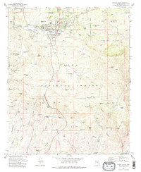
Editions of this 1973 Payson South Map
2 editions found
Other maps of this area

1887 · Verde
USGS Topo · 1:250,000

1892 · Verde
USGS Topo · 1:250,000

1934 · Pine
USGS Topo · 1:62,500

1934 · Promontory Butte
USGS Topo · 1:62,500

1936 · Payson
USGS Topo · 1:48,000

1937 · Diamond Butte
USGS Topo · 1:48,000

1939 · Promontory Butte
USGS Topo · 1:62,500

1940 · Pine
USGS Topo · 1:62,500

1942 · Payson
USGS Topo · 1:62,500

1943 · Diamond Butte
USGS Topo · 1:62,500