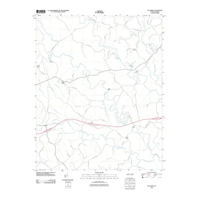
2010 Map of Pea Ridge
USGS Topo · Published 2010About this map
Pea Ridge serves as a central landmark in this portion of Polk County, where the terrain is defined by the convergence of the Green River and the Broad River. The landscape reflects a rural infrastructure of named crossings and family-associated locations, including Mills Bridge, Twitty Bridge, and Wilkins Bridge. Smaller communities like Beulah and Cox Store anchor the local road network, while the Pea Ridge Lookout Tower stands as a prominent high-point feature. Genealogists may find value in the location of the Walker Cemetery and numerous family-named routes such as Phillips Dairy Rd and Hugh Champion Rd. The drainage patterns of Wheat Creek, White Oak Creek, and Machine Creek illustrate the natural irrigation of the region prior to further modern development, preserving a detailed look at the area's mid-century rural character.
Find a feature on this map
67 named features on this map. Tap any name to fly to it.
Don’t see what you’re looking for? This feature index may not catch every label — zoom into the map to look around manually.
Map Details
Editions of this 2010 Pea Ridge Map
This is the sole edition of this map. No revisions or reprints were ever made.
Other maps of this area

1907 · Saluda
USGS Topo · 1:125,000

1953 · Charlotte
USGS Topo · 1:250,000

1954 · Charlotte
USGS Topo · 1:250,000

1955 · Knoxville
USGS Topo · 1:250,000

1957 · Knoxville
USGS Topo · 1:250,000

1959 · Lake Lure
USGS Topo · 1:62,500

1959 · Cowpens
USGS Topo · 1:62,500

1960 · Knoxville
USGS Topo · 1:250,000

1960 · Charlotte
USGS Topo · 1:250,000

1961 · Inman
USGS Topo · 1:62,500