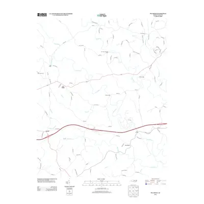
2013 Map of Pea Ridge
USGS Topo · Published 2013About this map
Pea Ridge and Beulah anchor this Polk County landscape where the river systems of the Blue Ridge foothills converge. The area is defined by the winding course of the Green River, which is spanned by several significant crossings including Mills Bridge, Wilkins Bridge, and Twitty Bridge. The presence of the Pea Ridge Lookout Tower atop the higher ground suggests the historical importance of forest surveillance in this timber-heavy region. To the north, the Broad River enters the frame, while the southern reaches are drained by White Oak Cr and its tributaries. Local transportation patterns are evident through historic thoroughfares like Old Highway 19 and modern routes such as US Highway 74, which bisects the terrain. Smaller community hubs like Cox Store and aviation facilities like Fox Haven Plantation Airport provide a glimpse into the rural infrastructure and land use of the early 21st century.
Find a feature on this map
96 named features on this map. Tap any name to fly to it.
Don’t see what you’re looking for? This feature index may not catch every label — zoom into the map to look around manually.
Map Details
Editions of this 2013 Pea Ridge Map
This is the sole edition of this map. No revisions or reprints were ever made.
Other maps of this area

1907 · Saluda
USGS Topo · 1:125,000

1953 · Charlotte
USGS Topo · 1:250,000

1954 · Charlotte
USGS Topo · 1:250,000

1955 · Knoxville
USGS Topo · 1:250,000

1957 · Knoxville
USGS Topo · 1:250,000

1959 · Lake Lure
USGS Topo · 1:62,500

1959 · Cowpens
USGS Topo · 1:62,500

1960 · Knoxville
USGS Topo · 1:250,000

1960 · Charlotte
USGS Topo · 1:250,000

1961 · Inman
USGS Topo · 1:62,500