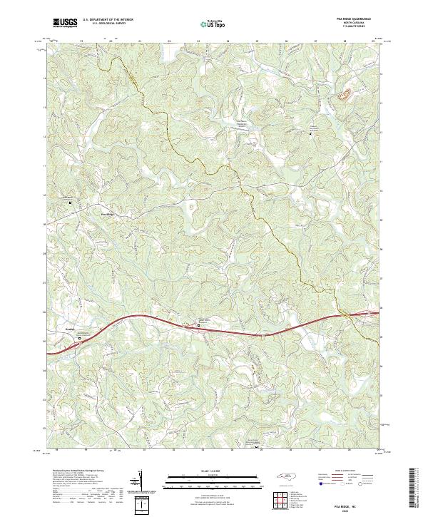
2022 Map of Pea Ridge
USGS Topo · Published 2022About this map
The Broad River and Green River converge near the border of Rutherford and Polk counties, carving a landscape defined by rolling hills and small creek valleys. This rural territory is anchored by the community of Pea Ridge and the settlement at Beulah. Local history and genealogy are deeply rooted in the area's country churches, such as Byars Baptist Church and Pleasant Hill Church, each with its own graveyard for researchers to trace family lineages. The presence of Fox Haven Plantation Airport near the Broad River indicates the modernization of these traditional agricultural lands. Small waterways like Wheat Cr and Mountain Creek weave through the terrain, illustrating the historical dependence on natural drainage for local homesteads. This map provides a look at the region’s development, where modern routes like Us 74 now bypass the older crossroads of the foothills.
Find a feature on this map
129 named features on this map. Tap any name to fly to it.
Don’t see what you’re looking for? This feature index may not catch every label — zoom into the map to look around manually.
Map Details
Editions of this 2022 Pea Ridge Map
This is the sole edition of this map. No revisions or reprints were ever made.
Other maps of this area

1907 · Saluda
USGS Topo · 1:125,000

1953 · Charlotte
USGS Topo · 1:250,000

1954 · Charlotte
USGS Topo · 1:250,000

1955 · Knoxville
USGS Topo · 1:250,000

1957 · Knoxville
USGS Topo · 1:250,000

1959 · Lake Lure
USGS Topo · 1:62,500

1959 · Cowpens
USGS Topo · 1:62,500

1960 · Knoxville
USGS Topo · 1:250,000

1960 · Charlotte
USGS Topo · 1:250,000

1961 · Inman
USGS Topo · 1:62,500