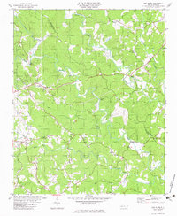
1982 Map of Pea Ridge
USGS Topo · Published 1983About this map
The confluence of the Green River and Broad River shapes this landscape on the border of Polk and Rutherford counties. The community of Pea Ridge serves as a central point in a region defined by its numerous rural congregations and family burial grounds. Religious life is well-documented through scattered landmarks such as Lebanon Ch, Pleasant Grove Ch, and Grays Chapel. The reliance on river crossings is evident through named structures like Mills Bridge and Wilkins Bridge, which connect the winding roads that follow the ridges between the deep valleys of Wheat Creek and Mountain Creek. A local Sandpit and a central Substation indicate the light industrial and utility infrastructure supporting these small Carolina communities in the late 20th century.
Find a feature on this map
32 named features on this map. Tap any name to fly to it.
Don’t see what you’re looking for? This feature index may not catch every label — zoom into the map to look around manually.
Map Details
Editions of this 1982 Pea Ridge Map
This is the sole edition of this map. No revisions or reprints were ever made.
Other maps of this area

1907 · Saluda
USGS Topo · 1:125,000

1953 · Charlotte
USGS Topo · 1:250,000

1954 · Charlotte
USGS Topo · 1:250,000

1955 · Knoxville
USGS Topo · 1:250,000

1957 · Knoxville
USGS Topo · 1:250,000

1959 · Lake Lure
USGS Topo · 1:62,500

1959 · Cowpens
USGS Topo · 1:62,500

1960 · Knoxville
USGS Topo · 1:250,000

1960 · Charlotte
USGS Topo · 1:250,000

1961 · Inman
USGS Topo · 1:62,500