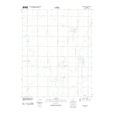
2009 Map of Peabody SE
USGS Topo · Published 2009About this map
The Whitewater River meanders across this rural section of Butler County, defining the agricultural landscape between the many grid-pattern roads. This area is characterized by its long-standing rural community foundations, evidenced by the distribution of four distinct burial grounds: Zion Cemetery, Pleasant View Cemetery, Fairmount Cemetery, and Holderman Cemetery. These sites provide significant points of interest for genealogists tracing early family settlements in the region. Beyond farming, the local economy is shaped by energy extraction, with the presence of the Elbing Oil Field and the Paulson Northeast Oil Field. The network of tributary waters, including Henry Creek and Edmonds Pool, further illustrates the drainage patterns and water management essential to the prairie landscape of central Kansas in the early 21st century.
Find a feature on this map
30 named features on this map. Tap any name to fly to it.
Don’t see what you’re looking for? This feature index may not catch every label — zoom into the map to look around manually.
Map Details
Editions of this 2009 Peabody SE Map
This is the sole edition of this map. No revisions or reprints were ever made.
Other maps of this area

1888 · Eldorado
USGS Topo · 1:125,000

1889 · Newton
USGS Topo · 1:125,000

1889 · Wichita
USGS Topo · 1:125,000

1894 · Wichita
USGS Topo · 1:125,000

1894 · Newton
USGS Topo · 1:125,000

1898 · Cottonwood Falls
USGS Topo · 1:125,000

1955 · Wichita
USGS Topo · 1:250,000

1955 · Hutchinson
USGS Topo · 1:250,000

1957 · Peabody NW
USGS Topo · 1:24,000

1957 · Florence
USGS Topo · 1:24,000