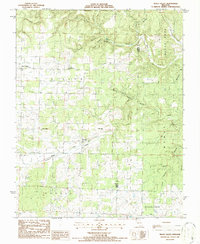
1986 Map of Peace Valley
USGS Topo · Published 1987About this map
The small rural community of Peace Valley sits at the heart of this mid-1980s landscape, serving as a hub for the surrounding Ozark plateau. To the southeast, the landscape transitions toward the unincorporated settlement of Fanchon along the Middle Fork Gunter Valley. The map reveals a deeply rooted social fabric through its country churches, including Hilltop Holiness Ch, Bennett Chapel, and Pilgrims Rest Ch.
Find a feature on this map
25 named features on this map. Tap any name to fly to it.
Don’t see what you’re looking for? This feature index may not catch every label — zoom into the map to look around manually.
Map Details
Editions of this 1986 Peace Valley Map
This is the sole edition of this map. No revisions or reprints were ever made.
Other maps of this area

1938 · West Plains
USGS Topo · 1:24,000

1940 · West Plains
USGS Topo · 1:24,000

1943 · Thayer
USGS Topo · 1:62,500

1944 · West Plains
USGS Topo · 1:62,500

1945 · Willow Springs
USGS Topo · 1:62,500

1945 · Montier
USGS Topo · 1:62,500

1946 · Thayer
USGS Topo · 1:62,500

1946 · West Plains
USGS Topo · 1:62,500

1948 · Montier
USGS Topo · 1:62,500

1948 · Willow Springs
USGS Topo · 1:62,500