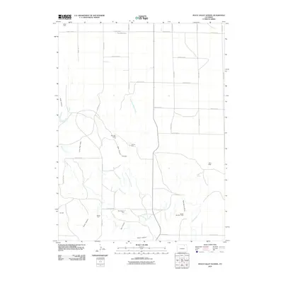
2010 Map of Peace Valley School
USGS Topo · Published 2010About this map
Peace Valley School stands as a focal point in this 2010 USGS survey of northern Morgan County, where the high plains landscape is defined by a grid of rural routes and an intricate network of water management. The terrain is marked by seasonal drainages and canyons, including Echo Canyon and Moon Canyon, which are part of a broader watershed feeding into Wildcat Creek.
Find a feature on this map
36 named features on this map. Tap any name to fly to it.
Don’t see what you’re looking for? This feature index may not catch every label — zoom into the map to look around manually.
Map Details
Editions of this 2010 Peace Valley School Map
This is the sole edition of this map. No revisions or reprints were ever made.
Other maps of this area

1951 · Weldona
USGS Topo · 1:24,000

1951 · Dead Horse Springs
USGS Topo · 1:24,000

1951 · Brush West
USGS Topo · 1:24,000

1951 · Peace Valley School
USGS Topo · 1:24,000

1951 · Judson Hills
USGS Topo · 1:24,000

1951 · Fort Morgan
USGS Topo · 1:24,000

1954 · Sterling
USGS Topo · 1:250,000

1958 · Sterling
USGS Topo · 1:250,000
1971 · Brush West
USGS Topo · 1:24,000
1971 · Fort Morgan
USGS Topo · 1:24,000