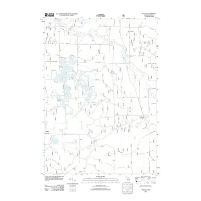
2012 Map of Peacock
USGS Topo · Published 2012About this map
The Little Manistee River and Big Sable River define the hydrography of this Lake County landscape, where glacial kettle lakes and wetland corridors dominate the terrain. Small settlements and crossroads like Peacock, Sauble, and Lukes Corners are connected by a grid of numbered roads, such as 8 Mile Rd and N Peacock Trl. In the northern section, the Irons Lookout Tower stands near the river valley, while further south, local history is preserved at the Lakeview Cem near the shores of Bluegill Lake. This environment is a dense cluster of water bodies including Bass Lake, Sauble Lakes, and the Twin Lakes at the southern boundary. The presence of the Leisure Time Campground suggests the area's continued role as a recreational destination for those navigating the numerous lakes and river bends in the early 21st century.
Find a feature on this map
59 named features on this map. Tap any name to fly to it.
Don’t see what you’re looking for? This feature index may not catch every label — zoom into the map to look around manually.
Map Details
Editions of this 2012 Peacock Map
This is the sole edition of this map. No revisions or reprints were ever made.
Other maps of this area

1931 · Baldwin NW
USGS Topo · 1:31,680

1931 · Custer NE
USGS Topo · 1:31,680

1931 · Baldwin NE
USGS Topo · 1:31,680

1932 · Freesoil SE
USGS Topo · 1:31,680

1933 · Peacock SE
USGS Topo · 1:31,680

1933 · Peacock SW
USGS Topo · 1:31,680

1933 · Peacock NE
USGS Topo · 1:31,680

1933 · Peacock NW
USGS Topo · 1:31,680

1954 · Traverse City
USGS Topo · 1:250,000

1954 · Milwaukee
USGS Topo · 1:250,000