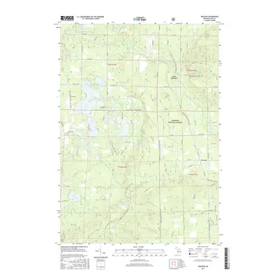
2017 Map of Peacock
USGS Topo · Published 2017About this map
Manistee National Forest covers much of this Lake County landscape, where the Little Manistee River and Big Sauble River drain a complex network of glacial kettle lakes. Small settlements such as Peacock and Little Manistee are connected by a grid of rural roads, including W 8 Mile Rd and N Peacock Trl. The area's recreational and natural character is highlighted by the N Country National Scenic Trail, which winds through the central and southern sections, passing landmarks like McCarthy Lake and Beaver Pond. Genealogical interest is anchored by Lakeview Cem located near Quick Lakes. The terrain is punctuated by rises such as Eden Mt, while the abundance of water bodies like Sauble Lakes, Loon Lake, and Zoba Lake suggests a long-standing history of seasonal residency and timber-related industry in the North Woods.
Find a feature on this map
68 named features on this map. Tap any name to fly to it.
Don’t see what you’re looking for? This feature index may not catch every label — zoom into the map to look around manually.
Map Details
Editions of this 2017 Peacock Map
This is the sole edition of this map. No revisions or reprints were ever made.
Other maps of this area

1931 · Baldwin NW
USGS Topo · 1:31,680

1931 · Custer NE
USGS Topo · 1:31,680

1931 · Baldwin NE
USGS Topo · 1:31,680

1932 · Freesoil SE
USGS Topo · 1:31,680

1933 · Peacock SE
USGS Topo · 1:31,680

1933 · Peacock SW
USGS Topo · 1:31,680

1933 · Peacock NE
USGS Topo · 1:31,680

1933 · Peacock NW
USGS Topo · 1:31,680

1954 · Traverse City
USGS Topo · 1:250,000

1954 · Milwaukee
USGS Topo · 1:250,000