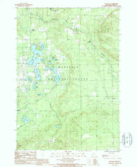
1987 Map of Peacock
USGS Topo · Published 1988About this map
The Manistee National Forest covers much of this landscape, where the headwaters and tributaries of the Big Sauble River and Little Manistee River carve through the glacial terrain of Lake County. This late-1980s provisional map documents a region defined by its water and woods, showing the transition from the Ward Hills in the southwest toward the scattered lakes of the central forest. The small settlements of Peacock, Little Manistee, and Lukes Corners serve as the primary human anchors in an area otherwise dominated by nature and early resource extraction.
Find a feature on this map
34 named features on this map. Tap any name to fly to it.
Don’t see what you’re looking for? This feature index may not catch every label — zoom into the map to look around manually.
Map Details
Editions of this 1987 Peacock Map
This is the sole edition of this map. No revisions or reprints were ever made.
Other maps of this area

1931 · Baldwin NW
USGS Topo · 1:31,680

1931 · Custer NE
USGS Topo · 1:31,680

1931 · Baldwin NE
USGS Topo · 1:31,680

1932 · Freesoil SE
USGS Topo · 1:31,680

1933 · Peacock SE
USGS Topo · 1:31,680

1933 · Peacock SW
USGS Topo · 1:31,680

1933 · Peacock NE
USGS Topo · 1:31,680

1933 · Peacock NW
USGS Topo · 1:31,680

1954 · Traverse City
USGS Topo · 1:250,000

1954 · Milwaukee
USGS Topo · 1:250,000