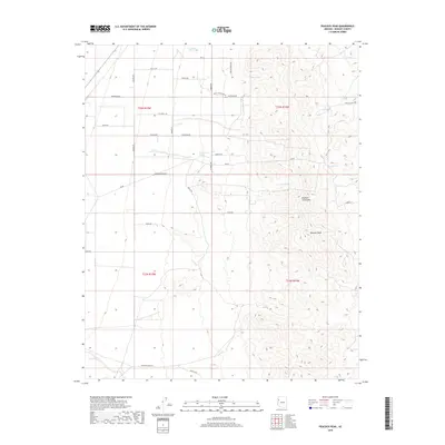
2018 Map of Peacock Peak
USGS Topo · Published 2018About this map
Peacock Peak rises as the central landmark of the Peacock Mountains in this Mohave County landscape. The area is defined by its critical water sources, with numerous named springs such as Mine Spring, Trap Spring, and Crescent Spring dotting the high desert terrain. These points likely served as essential stops for early travelers and ranchers navigating the arid stretches of western Arizona. The road network reflects a history of land use and rural access, with routes like Grounds Ranch Rd and Ranch Trl indicating the livestock operations that have long shaped the region's economy. Smaller thoroughfares like Five Wells Rd and Mountain View Rd provide a clear view of the sparse but deliberate layout of rural Mohave County properties in the early 21st century.
Find a feature on this map
30 named features on this map. Tap any name to fly to it.
Don’t see what you’re looking for? This feature index may not catch every label — zoom into the map to look around manually.
Map Details
Editions of this 2018 Peacock Peak Map
This is the sole edition of this map. No revisions or reprints were ever made.
Other maps of this area

1886 · Diamond Creek
USGS Topo · 1:250,000

1892 · Diamond Creek
USGS Topo · 1:250,000

1948 · Williams
USGS Topo · 1:250,000

1954 · Williams
USGS Topo · 1:250,000

1956 · Williams
USGS Topo · 1:250,000

1960 · Williams
USGS Topo · 1:250,000

1961 · Williams
USGS Topo · 1:250,000
1968 · Long Mountain
USGS Topo · 1:24,000
1968 · Kingman Airport
USGS Topo · 1:24,000
1968 · Peacock Peak
USGS Topo · 1:24,000