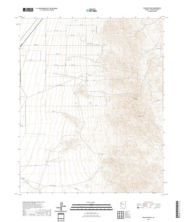
2021 Map of Peacock Peak
USGS Topo · Published 2021About this map
Peacock Peak dominates the eastern landscape of this high-desert region in Mohave County, forming part of the Peacock Mountains chain. The arid terrain is marked by a network of critical water sources, including North Water Spring, Willow Spring, and the tellingly named Mine Spring. While much of the area remains undeveloped, the western portion shows a grid of rural access roads like Olympic Rd and Peacock Rd, indicating modern settlement patterns and ranching activity. The presence of Happy Trails Ranch and Grounds Ranch Rd highlights the area's continued use for livestock and private landholding. This survey captures the intersection of traditional western ranching with modern desert habitation, evidenced by the named thoroughfares that crisscross the foothills and basins surrounding the prominent mountain peaks.
Find a feature on this map
31 named features on this map. Tap any name to fly to it.
Don’t see what you’re looking for? This feature index may not catch every label — zoom into the map to look around manually.
Map Details
Editions of this 2021 Peacock Peak Map
This is the sole edition of this map. No revisions or reprints were ever made.
Other maps of this area

1886 · Diamond Creek
USGS Topo · 1:250,000

1892 · Diamond Creek
USGS Topo · 1:250,000

1948 · Williams
USGS Topo · 1:250,000

1954 · Williams
USGS Topo · 1:250,000

1956 · Williams
USGS Topo · 1:250,000

1960 · Williams
USGS Topo · 1:250,000

1961 · Williams
USGS Topo · 1:250,000
1968 · Long Mountain
USGS Topo · 1:24,000
1968 · Kingman Airport
USGS Topo · 1:24,000
1968 · Peacock Peak
USGS Topo · 1:24,000