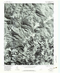
1977 Map of Peaks of Otter
USGS Topo · Published 1983About this map
The Blue Ridge dominates this 1970s orthophotoquad, showing the transition from the high elevations of the Peaks of Otter down toward the valley floor. Small clusters of rural activity center around historic mill sites and crossings, including Penicks Mill and Kelso Mill. The orthophoto format provides an authentic look at the land use during this era, revealing the balance between forested slopes and the cleared agricultural fields surrounding Peaksville. Water resources are central to the landscape, with the Bedford Reservoir and the Big Otter River serving as primary landmarks. The drainage patterns of Stony Creek, Jennings Creek, and Sheep Creek define the local topography, carving through the ridges to support the small settlements and homesteads that have long characterized this part of Virginia.
Find a feature on this map
10 named features on this map. Tap any name to fly to it.
Don’t see what you’re looking for? This feature index may not catch every label — zoom into the map to look around manually.
Map Details
Editions of this 1977 Peaks of Otter Map
This is the sole edition of this map. No revisions or reprints were ever made.
Other maps of this area

1890 · Roanoke
USGS Topo · 1:125,000

1891 · Roanoke
USGS Topo · 1:125,000

1892 · Lynchburg
USGS Topo · 1:125,000

1894 · Natural Bridge
USGS Topo · 1:125,000

1894 · Lexington
USGS Topo · 1:125,000

1894 · Natural Bridge
USGS Topo · 1:62,500

1907 · Natural Bridge Special
USGS Topo · 1:62,500

1935 · Buena Vista
USGS Topo · 1:48,000

1939 · Buena Vista
USGS Topo · 1:62,500

1940 · Buena Vista
USGS Topo · 1:62,500