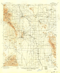
1916 Map of Pearce
USGS Topo · Published 1948About this map
Mining operations and cattle ranches dominate this landscape in Cochise County, captured during a 1913–1914 survey. The copper boom is evident in the cluster of activity around the Dragoon Mountains, where Gordon Camp and Dragoon Camp sit near jagged peaks like China Pk and Cochise Pk. The valley floor is crisscrossed by competing rail lines, including the Arizona Eastern and the El Paso and Southwestern, which served established mining towns like Pearce and the mining camp at Courtland.
Find a feature on this map
88 named features on this map. Tap any name to fly to it.
Don’t see what you’re looking for? This feature index may not catch every label — zoom into the map to look around manually.
Map Details
Editions of this 1916 Pearce Map
3 editions found
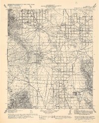
Other maps of this area

1902 · Bisbee
USGS Topo · 1:62,500

1910 · Bisbee
USGS Topo · 1:62,500

1914 · Hereford
USGS Topo · 1:125,000

1914 · Douglas
USGS Topo · 1:62,500

1915 · Benson
USGS Topo · 1:125,000

1916 · Pearce
USGS Topo · 1:125,000

1916 · Douglas
USGS Topo · 1:125,000

1917 · San Simon
USGS Topo · 1:125,000

1917 · Chiricahua
USGS Topo · 1:125,000

1919 · Douglas
USGS Topo · 1:125,000