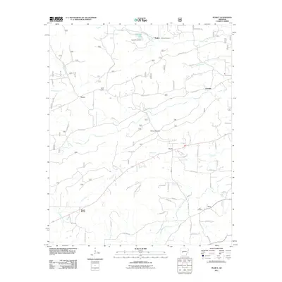
2011 Map of Pearcy
USGS Topo · Published 2011About this map
Pearcy serves as a central hub in this western Arkansas landscape, where the topography transitions between the heights of Pearcy Mountain and the fertile bottomlands of the Mazarn Creek and Little Mazarn Creek drainage basins. For genealogists and local historians, the sheet identifies several distinct family and community burial grounds, including McDowell Cemetery, Oma Cemetery, and Cross Roads Cemetery. These sites are linked by a network of historic roads such as Old Dallas Rd and Caddo Gap Rd, which connect small settlements like Maddox, Chandler, and Mount Moriah. To the north, Reynolds Lake Dam marks a point of water management on Cearley Creek, while the presence of Nubbin Ridge Rd suggests the winding character of the higher terrain near the Garland and Hot Spring County borders. This survey captures the rural residential patterns of the early 21st century just before the further expansion of suburban corridors near the Hot Springs area.
Find a feature on this map
96 named features on this map. Tap any name to fly to it.
Don’t see what you’re looking for? This feature index may not catch every label — zoom into the map to look around manually.
Map Details
Editions of this 2011 Pearcy Map
This is the sole edition of this map. No revisions or reprints were ever made.
Other maps of this area

1890 · Hot Springs
USGS Topo · 1:125,000

1894 · Hot Springs
USGS Topo · 1:125,000

1955 · Little Rock
USGS Topo · 1:250,000

1956 · Little Rock
USGS Topo · 1:250,000

1960 · Little Rock
USGS Topo · 1:250,000

1962 · Crystal Springs
USGS Topo · 1:24,000

1962 · Mc Graw Mountain
USGS Topo · 1:24,000

1964 · Little Rock
USGS Topo · 1:250,000

1966 · Pearcy
USGS Topo · 1:24,000

1966 · Hempwallace
USGS Topo · 1:24,000