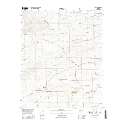
2014 Map of Pearcy
USGS Topo · Published 2014About this map
Ouachita National Forest lands dominate the northern and central sections of this landscape, where the terrain is defined by the steady rise of Nubbin Ridge and Pearcy Mtn. The 2014 survey reveals a transition from these protected timberlands to a series of rural communities and crossroads, including Pearcy, Meyers, and Maddox. The road network, including the modern corridor of US Hwy 70, connects established points like Mount Moriah to the outlying settlement of Oma near the southern boundary. Local history and genealogy are anchored by several small burial sites such as McDowell Cem and Oma Cem, while the hydrological landscape is shaped by the winding courses of Meyers Cr, Cearley Cr, and Little Mazarn Cr, illustrating a rural economy historically tied to both the forest and local waterways.
Find a feature on this map
79 named features on this map. Tap any name to fly to it.
Don’t see what you’re looking for? This feature index may not catch every label — zoom into the map to look around manually.
Map Details
Editions of this 2014 Pearcy Map
This is the sole edition of this map. No revisions or reprints were ever made.
Other maps of this area

1890 · Hot Springs
USGS Topo · 1:125,000

1894 · Hot Springs
USGS Topo · 1:125,000

1955 · Little Rock
USGS Topo · 1:250,000

1956 · Little Rock
USGS Topo · 1:250,000

1960 · Little Rock
USGS Topo · 1:250,000

1962 · Crystal Springs
USGS Topo · 1:24,000

1962 · Mc Graw Mountain
USGS Topo · 1:24,000

1964 · Little Rock
USGS Topo · 1:250,000

1966 · Pearcy
USGS Topo · 1:24,000

1966 · Hempwallace
USGS Topo · 1:24,000