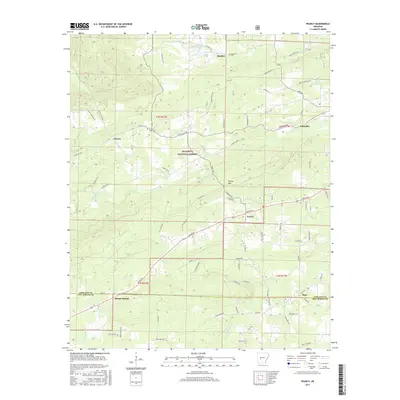
2017 Map of Pearcy
USGS Topo · Published 2017About this map
The boundary between Garland and Hot Spring counties bisects this 2017 study of the rural Arkansas interior. Small settlements and crossroads like Pearcy and Oma serve as the primary hubs, surrounded by family-named cemeteries and landmarks that speak to the long-standing agricultural and forestry roots of the region. Much of the northern terrain is occupied by the Ouachita National Forest, where topography is defined by features such as Pearcy Mtn and the creek valleys of Meyers Cr and Cearley Cr.
Find a feature on this map
66 named features on this map. Tap any name to fly to it.
Don’t see what you’re looking for? This feature index may not catch every label — zoom into the map to look around manually.
Map Details
Editions of this 2017 Pearcy Map
This is the sole edition of this map. No revisions or reprints were ever made.
Other maps of this area

1890 · Hot Springs
USGS Topo · 1:125,000

1894 · Hot Springs
USGS Topo · 1:125,000

1955 · Little Rock
USGS Topo · 1:250,000

1956 · Little Rock
USGS Topo · 1:250,000

1960 · Little Rock
USGS Topo · 1:250,000

1962 · Crystal Springs
USGS Topo · 1:24,000

1962 · Mc Graw Mountain
USGS Topo · 1:24,000

1964 · Little Rock
USGS Topo · 1:250,000

1966 · Pearcy
USGS Topo · 1:24,000

1966 · Hempwallace
USGS Topo · 1:24,000