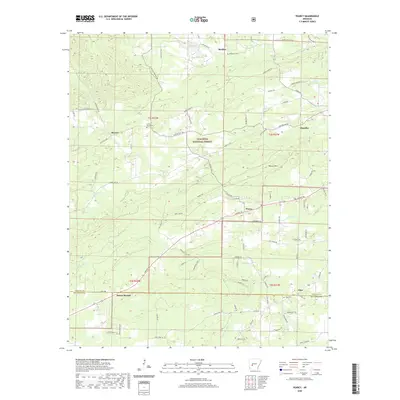
2020 Map of Pearcy
USGS Topo · Published 2020About this map
Ouachita National Forest lands dominate the central landscape of this 2020 survey, where the forested ridges of Pearcy Mtn transition into the drainages of Mazarn Cr and Little Mazarn Cr. Small, established communities like Pearcy and Oma serve as focal points for local residents, while the settlement of Mount Moriah sits along the southern border. The map provides valuable details for family history research, marking several burial grounds including McDowell Cem in the north and Oma Cem in the southeast. Historical road patterns are well-documented through labels such as Old Dallas Rd and Caddo Gap Rd, reflecting the traditional transit routes through this portion of Garland County and Hot Spring County. Notable water features like Reynolds Lake and the meandering path of Lost Cr further define the local geography.
Find a feature on this map
78 named features on this map. Tap any name to fly to it.
Don’t see what you’re looking for? This feature index may not catch every label — zoom into the map to look around manually.
Map Details
Editions of this 2020 Pearcy Map
This is the sole edition of this map. No revisions or reprints were ever made.
Other maps of this area

1890 · Hot Springs
USGS Topo · 1:125,000

1894 · Hot Springs
USGS Topo · 1:125,000

1955 · Little Rock
USGS Topo · 1:250,000

1956 · Little Rock
USGS Topo · 1:250,000

1960 · Little Rock
USGS Topo · 1:250,000

1962 · Crystal Springs
USGS Topo · 1:24,000

1962 · Mc Graw Mountain
USGS Topo · 1:24,000

1964 · Little Rock
USGS Topo · 1:250,000

1966 · Pearcy
USGS Topo · 1:24,000

1966 · Hempwallace
USGS Topo · 1:24,000