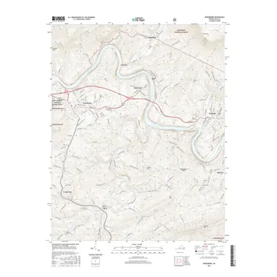
2016 Map of Pearisburg
USGS Topo · Published 2016About this map
The New River carves a dramatic serpentine path through Giles County in this 2016 survey, defining the industrial and residential corridors of Pearisburg and Pembroke. The Norfolk Southern railroad tracks mirror the river's winding course, serving the riverside industrial sites and smaller settlements like Ripplemead, Klotz, and Norcross. To the north and south, the terrain rises sharply toward the Jefferson National Forest, where the Appalachian National Scenic Trail traverses the high ridges near Butt Mtn.
Find a feature on this map
152 named features on this map. Tap any name to fly to it.
Don’t see what you’re looking for? This feature index may not catch every label — zoom into the map to look around manually.
Map Details
Editions of this 2016 Pearisburg Map
This is the sole edition of this map. No revisions or reprints were ever made.
Other maps of this area

1890 · Dublin
USGS Topo · 1:125,000

1891 · Dublin
USGS Topo · 1:125,000

1913 · Peterstown
USGS Topo · 1:48,000

1916 · Peterstown
USGS Topo · 1:62,500

1923 · Pearisburg
USGS Topo · 1:62,500

1925 · Peterstown
USGS Topo · 1:62,500

1932 · Peterstown
USGS Topo · 1:48,000

1932 · Pearisburg
USGS Topo · 1:48,000

1934 · Pulaski
USGS Topo · 1:48,000

1937 · Pearisburg
USGS Topo · 1:62,500