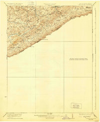
1923 Map of Pearisburg
USGS Topo · Published 1929About this map
Peters Mountain dominates this survey, forming the dramatic interstate boundary between West Virginia and Virginia. The West Virginia side, spanning the districts of Springfield and Red Sulphur, reveals a densely settled rural landscape defined by narrow hollows and ridge-top communities. The abundance of educational and religious institutions, such as Swope School, Shires School, and Pine Grove Church, suggests a period of high rural population density before mid-century shifts. Narrow watercourses like Hans Creek and Rich Creek dictate the placement of small settlements like Linside and Assurance. On the eastern edge, the legendary Sweet Springs remains a focal point of the region. This 1920s-era topographic record captures the Appalachian highlands at a peak of agrarian life, where mountain passes like Dickinson Gap and Symms Gap served as essential links between the valley communities.
Find a feature on this map
38 named features on this map. Tap any name to fly to it.
Don’t see what you’re looking for? This feature index may not catch every label — zoom into the map to look around manually.
Map Details
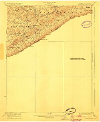
Editions of this 1923 Pearisburg Map
3 editions found

Other maps of this area

1887 · Hinton
USGS Topo · 1:125,000

1887 · Lewisburg
USGS Topo · 1:125,000

1890 · Dublin
USGS Topo · 1:125,000

1890 · Christiansburg
USGS Topo · 1:125,000

1891 · Lewisburg
USGS Topo · 1:125,000

1891 · Dublin
USGS Topo · 1:125,000

1892 · Hinton
USGS Topo · 1:125,000

1912 · Big Bend
USGS Topo · 1:62,500

1913 · Peterstown
USGS Topo · 1:48,000

1914 · Big Bend
USGS Topo · 1:62,500