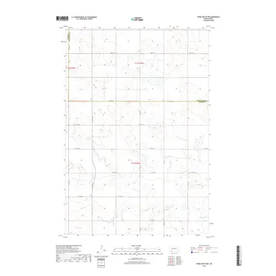
2018 Map of Pearl Butte NW
USGS Topo · Published 2018About this map
Cedar Creek meanders through the southern half of this landscape, its winding course defining the low-lying drainage patterns of the high plains. Situated along the boundary where Hettinger Co and Adams Co meet, the area is organized by a strict cardinal grid of rural section roads. This geometric network includes routes such as 82nd St SW and 102 Ave SW, which facilitate movement across a terrain primarily defined by subtle elevation changes and seasonal wetlands. The map illustrates the persistent structure of North Dakota’s township and range system, where developments like 15th Ave NE and 10th Ave NE serve as the primary conduits for the agricultural economy in the late twenty-first century.
Find a feature on this map
20 named features on this map. Tap any name to fly to it.
Don’t see what you’re looking for? This feature index may not catch every label — zoom into the map to look around manually.
Map Details
Editions of this 2018 Pearl Butte NW Map
This is the sole edition of this map. No revisions or reprints were ever made.
Other maps of this area

1953 · Dickinson
USGS Topo · 1:250,000

1957 · Dickinson
USGS Topo · 1:250,000

1966 · Mott South
USGS Topo · 1:24,000

1966 · Mott SW
USGS Topo · 1:24,000

1973 · Abbey Hill
USGS Topo · 1:24,000

1974 · Pearl Butte NW
USGS Topo · 1:24,000

1974 · Long Butte
USGS Topo · 1:24,000

1980 · Mott
USGS Topo · 1:100,000
2011 · Taylor Butte SE
USGS Topo · 1:24,000
2011 · Barths Butte
USGS Topo · 1:24,000