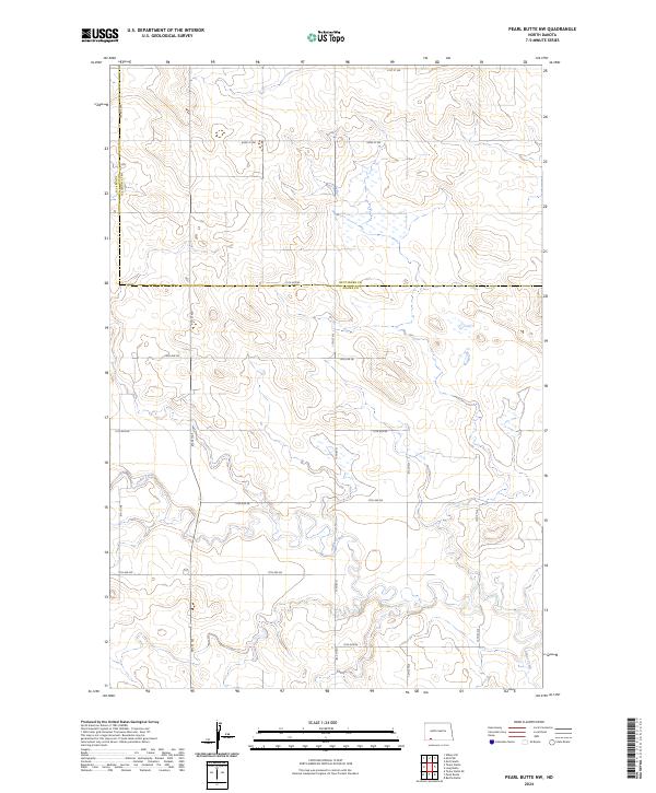
2024 Map of Pearl Butte NW
USGS Topo · Published 2024About this map
Cedar Creek meanders across the southern and western portions of this North Dakota landscape, defining the local drainage patterns near the border of Hettinger and Adams counties. The area is characterized by a high-plains topography where the land rises into prominent buttes and ridges, typical of the region's unglaciated terrain. A disciplined grid of rural roads, such as 81st St SW and 15th Ave NE, provides the primary structure for land access and agricultural management. This 2024 survey reflects the modern configuration of these prairie lands, where the PLSS township boundaries of t132n r94w and t131n r94w intersect. The map serves as a contemporary record of the sparsely populated ranching and farming country, detailing the precise drainage of Cedar Creek tributaries and the maintained section-line road network.
Find a feature on this map
21 named features on this map. Tap any name to fly to it.
Don’t see what you’re looking for? This feature index may not catch every label — zoom into the map to look around manually.
Map Details
Editions of this 2024 Pearl Butte NW Map
This is the sole edition of this map. No revisions or reprints were ever made.
Other maps of this area

1953 · Dickinson
USGS Topo · 1:250,000

1957 · Dickinson
USGS Topo · 1:250,000

1966 · Mott South
USGS Topo · 1:24,000

1966 · Mott SW
USGS Topo · 1:24,000

1973 · Abbey Hill
USGS Topo · 1:24,000

1974 · Pearl Butte NW
USGS Topo · 1:24,000

1974 · Long Butte
USGS Topo · 1:24,000

1980 · Mott
USGS Topo · 1:100,000
2011 · Taylor Butte SE
USGS Topo · 1:24,000
2011 · Barths Butte
USGS Topo · 1:24,000