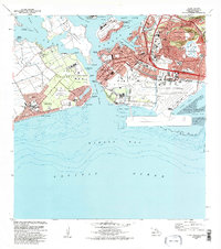
1983 Map of Pearl Harbor
USGS Topo · Published 1984About this map
Ford Island and the Pearl Harbor Naval Base stand at the center of this 1980s landscape, illustrating the complex military and civil infrastructure of South Oahu. The map details the dense arrangement of the Hickam Air Force Base adjacent to the runways of Honolulu International Airport. Notable memorials for the USS Arizona and USS Utah are marked within the lochs, while the residential growth of the era is evident in Ewa Beach and Foster Village.
Find a feature on this map
71 named features on this map. Tap any name to fly to it.
Don’t see what you’re looking for? This feature index may not catch every label — zoom into the map to look around manually.
Map Details
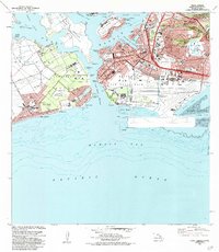
Editions of this 1983 Pearl Harbor Map
2 editions found
Other maps of this area

1953 · Schofield Barracks
USGS Topo · 1:24,000

1953 · Honolulu
USGS Topo · 1:24,000

1953 · Ewa
USGS Topo · 1:24,000

1953 · Puuloa
USGS Topo · 1:24,000

1954 · Oahu
USGS Topo · 1:250,000

1954 · Kaneohe
USGS Topo · 1:24,000

1954 · Waipahu
USGS Topo · 1:24,000

1959 · Kaneohe
USGS Topo · 1:24,000

1959 · Honolulu
USGS Topo · 1:24,000

1959 · Waipahu
USGS Topo · 1:24,000