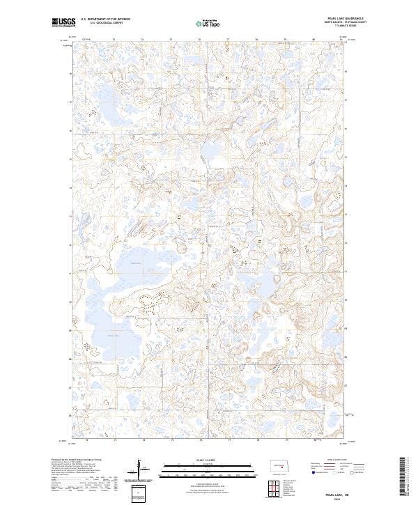
2024 Map of Pearl Lake
USGS Topo · Published 2024About this map
The glacial prairie landscape of central Stutsman County is defined here by the extensive tracts of the Stutsman County Waterfowl Production Area. This conservation network spans several townships, preserving the complex wetland ecosystems that characterize the region's pothole topography. Named water bodies like Pearl Lake and Mud Lake provide essential anchor points within this aquatic terrain, which is otherwise marked by unnamed ponds and seasonal sloughs. A grid of section roads, including 56th Ave SE and 24th St SE, maintains the traditional land division of the North Dakota plains, providing access to these protected lands while reflecting the enduring agricultural geometry of the county.
Find a feature on this map
22 named features on this map. Tap any name to fly to it.
Don’t see what you’re looking for? This feature index may not catch every label — zoom into the map to look around manually.
Map Details
Editions of this 2024 Pearl Lake Map
This is the sole edition of this map. No revisions or reprints were ever made.
Other maps of this area

1952 · New Rockford
USGS Topo · 1:250,000

1953 · Jamestown
USGS Topo · 1:250,000

1954 · Cleveland NW
USGS Topo · 1:24,000

1954 · Medina
USGS Topo · 1:24,000

1955 · Crystal Springs
USGS Topo · 1:24,000

1956 · New Rockford
USGS Topo · 1:250,000

1956 · Jamestown
USGS Topo · 1:250,000
1958 · Goldwin SW
USGS Topo · 1:24,000

1958 · Goldwin
USGS Topo · 1:24,000

1971 · New Rockford
USGS Topo · 1:250,000