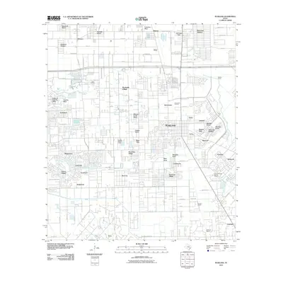
2010 Map of Pearland
USGS Topo · Published 2010About this map
Pearland serves as the central hub of this South Texas landscape, surrounded by an intricate web of suburban residential developments and critical energy infrastructure. The city's growth is evident in the dense street grids of neighborhoods like Southdown, Westminster, and Regency Park, while older historical markers like the Old Pearland Cemetery provide a link to the community's past. The landscape is deeply tied to the regional oil economy, evidenced by the Mykawa Oil Field and Manvel Oil Field, which share space with numerous small aviation facilities such as Skyway Manor Airport and the Houston Airpark. Hydrological features like Clear Creek and Hickory Slough meander through the terrain, intersecting major transit corridors like Beltway 8. To the south, Hastings Siding points to the area's rail history, while Brookside Village maintains a distinct identity amidst the expanding Houston metropolitan reach.
Find a feature on this map
80 named features on this map. Tap any name to fly to it.
Don’t see what you’re looking for? This feature index may not catch every label — zoom into the map to look around manually.
Map Details
Editions of this 2010 Pearland Map
This is the sole edition of this map. No revisions or reprints were ever made.
Other maps of this area

1915 · Bellaire
USGS Topo · 1:24,000

1915 · Park Place
USGS Topo · 1:24,000

1915 · Deepwater
USGS Topo · 1:24,000

1916 · Genoa
USGS Topo · 1:24,000

1919 · Deepwater
USGS Topo · 1:31,680

1920 · Genoa
USGS Topo · 1:31,680

1920 · Mykawa
USGS Topo · 1:31,680

1920 · Almeda
USGS Topo · 1:31,680

1921 · Bellaire
USGS Topo · 1:31,680

1922 · Park Place
USGS Topo · 1:31,680