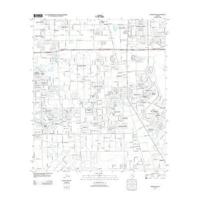
2013 Map of Pearland
USGS Topo · Published 2013About this map
Mykawa Oil Field and the Manvel Oil Field define the subterranean wealth that shaped this part of the Texas Gulf Coast, shown here in the early 21st century. The landscape is a complex patchwork of suburban expansion and industrial legacies, where established residential areas like Almeda Genoa, Brookside Village, and Skyscraper Shadows sit alongside significant aviation infrastructure. General aviation is particularly prominent, with the Skyway Manor Airport, Houston Airpark, and A&A Flying Service Airport all serving the region south of the S Sam Houston Pkwy E. Waterways such as Clear Creek, Marys Creek, and Mustang Bayou meander through the grid of modern subdivisions, while the Old Pearland Cem and Dagg Cem provide genealogical anchors for local families. The southern edge of the map near Hastings Siding reveals the transition from dense residential clusters to more industrial and agricultural spaces.
Find a feature on this map
56 named features on this map. Tap any name to fly to it.
Don’t see what you’re looking for? This feature index may not catch every label — zoom into the map to look around manually.
Map Details
Editions of this 2013 Pearland Map
This is the sole edition of this map. No revisions or reprints were ever made.
Other maps of this area

1915 · Bellaire
USGS Topo · 1:24,000

1915 · Park Place
USGS Topo · 1:24,000

1915 · Deepwater
USGS Topo · 1:24,000

1916 · Genoa
USGS Topo · 1:24,000

1919 · Deepwater
USGS Topo · 1:31,680

1920 · Genoa
USGS Topo · 1:31,680

1920 · Mykawa
USGS Topo · 1:31,680

1920 · Almeda
USGS Topo · 1:31,680

1921 · Bellaire
USGS Topo · 1:31,680

1922 · Park Place
USGS Topo · 1:31,680