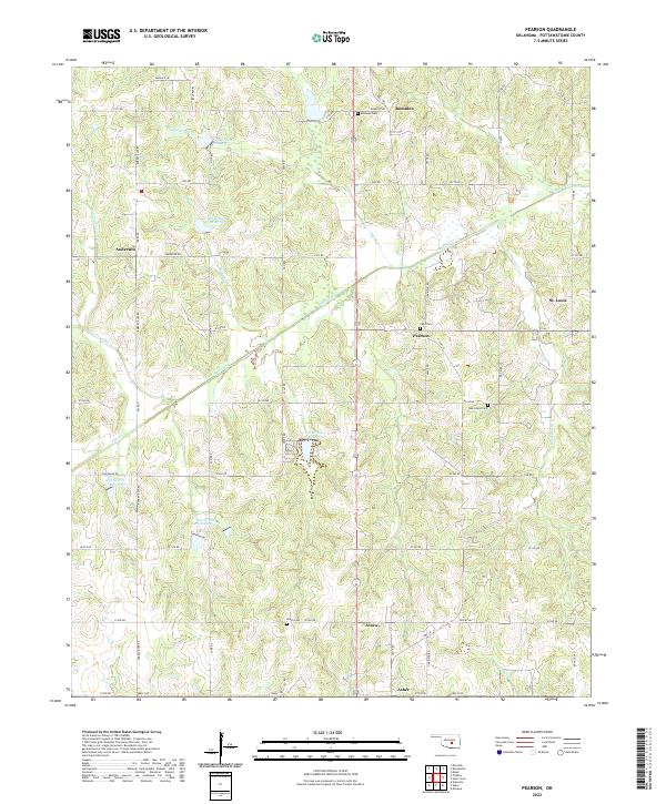
2022 Map of Pearson
USGS Topo · Published 2022About this map
The rolling agricultural and oil-producing landscape of southern Pottawatomie County is defined by its small crossroads settlements and complex drainage systems. Salt Creek and its many tributaries, including Opossum Cr and Delaware Cr, cut through the terrain, punctuated by a series of modern water management features like Salt Cr Site 24 Reservoir and Salt Cr Site 3 Reservoir. This area, once part of the Citizen Potawatomi and Sacred Heart Mission lands, retains its rural character through established communities such as Pearson and Romulus. Local genealogy is well-served by the presence of several community burial grounds, including Light Cem near the center of the sheet and Oak Grove Cem further south. The map illustrates the persistent grid of section-line roads, such as Skelly Rd and Romulus Rd, that connect these historic hamlets to the town of Asher at the southern edge of the quadrangle.
Find a feature on this map
63 named features on this map. Tap any name to fly to it.
Don’t see what you’re looking for? This feature index may not catch every label — zoom into the map to look around manually.
Map Details
Editions of this 2022 Pearson Map
This is the sole edition of this map. No revisions or reprints were ever made.
Other maps of this area

1896 · Seminole and Prague
USGS Topo · 1:125,000

1898 · Purcell
USGS Topo · 1:125,000

1898 · Pauls Valley
USGS Topo · 1:125,000

1901 · Stonewall
USGS Topo · 1:125,000

1902 · Pauls Valley
USGS Topo · 1:125,000

1907 · Maud
USGS Topo · 1:62,500

1908 · Maud
USGS Topo · 1:62,500

1910 · McComb
USGS Topo · 1:62,500

1954 · Oklahoma City
USGS Topo · 1:250,000

1957 · Ardmore
USGS Topo · 1:250,000