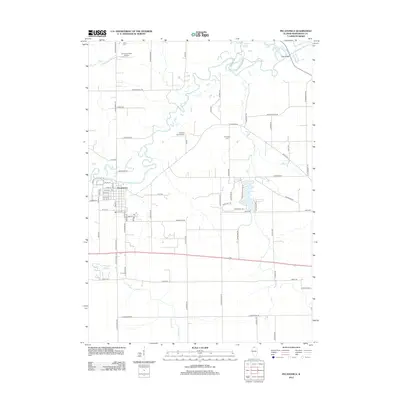
2012 Map of Pecatonica
USGS Topo · Published 2012About this map
The winding Pecatonica River defines the geography of this northern Illinois landscape, carving a serpentine path through the fertile plains of Winnebago County. The village of Pecatonica serves as the central hub, its residential grid oriented around the local Post Office and extending toward the river's edge. This 2012 survey illustrates the transition from rural agricultural land to modern rural aviation and suburban development, as seen in the residential clusters near Westlake Village Drive and the presence of small airfields like O'Connor Field Airport.
Find a feature on this map
73 named features on this map. Tap any name to fly to it.
Don’t see what you’re looking for? This feature index may not catch every label — zoom into the map to look around manually.
Map Details
Editions of this 2012 Pecatonica Map
This is the sole edition of this map. No revisions or reprints were ever made.
Other maps of this area

1917 · Kings
USGS Topo · 1:62,500

1918 · Rockford
USGS Topo · 1:62,500

1918 · Kings
USGS Topo · 1:62,500

1922 · Oregon
USGS Topo · 1:62,500

1924 · Oregon
USGS Topo · 1:62,500

1932 · Pecatonica
USGS Topo · 1:62,500

1936 · Pecatonica
USGS Topo · 1:62,500

1938 · Rockford
USGS Topo · 1:62,500

1954 · Rockford
USGS Topo · 1:250,000

1955 · Rockford
USGS Topo · 1:250,000