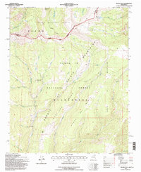
1995 Map of Pecos Falls
USGS Topo · Published 1997About this map
The Sangre de Cristo Mountains define this high-altitude landscape where the headwaters of the Pecos River begin their descent. This 1995 revision, based on photographs dating back to 1958, illustrates the convergence of the Carson National Forest and Santa Fe National Forest within the protected Pecos Wilderness. The topography is dominated by massive landforms like Hamilton Mesa and the Bordo del Medio, which direct the flow of numerous alpine drainages including the Middle Fork Santa Barbara and Rito del Padre.
Find a feature on this map
36 named features on this map. Tap any name to fly to it.
Don’t see what you’re looking for? This feature index may not catch every label — zoom into the map to look around manually.
Map Details
Editions of this 1995 Pecos Falls Map
This is the sole edition of this map. No revisions or reprints were ever made.
Other maps of this area

1889 · Las Vegas
USGS Topo · 1:125,000

1889 · Santa Fe
USGS Topo · 1:125,000

1891 · Las Vegas
USGS Topo · 1:125,000

1893 · Las Vegas
USGS Topo · 1:125,000

1894 · Santa Fe
USGS Topo · 1:125,000

1954 · Santa Fe
USGS Topo · 1:250,000

1954 · Raton
USGS Topo · 1:250,000

1958 · Raton
USGS Topo · 1:250,000

1958 · Santa Fe
USGS Topo · 1:250,000
1961 · Cowles
USGS Topo · 1:24,000