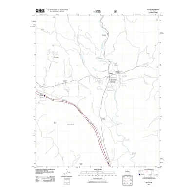
2011 Map of Pecos
USGS Topo · Published 2011About this map
The Pecos River carves through this northern New Mexico landscape, serving as the primary corridor for settlement and transit near the southern terminus of the Sangre de Cristo Mountains. Central to the map is the village of Pecos, flanked by its neighbors East Pecos and La Cueva. The cultural depth of the valley is evident in the presence of the Pecos National Hist Park and the Valencia Ranch Archaeological site, reflecting centuries of human habitation.
Find a feature on this map
43 named features on this map. Tap any name to fly to it.
Don’t see what you’re looking for? This feature index may not catch every label — zoom into the map to look around manually.
Map Details
Editions of this 2011 Pecos Map
This is the sole edition of this map. No revisions or reprints were ever made.
Other maps of this area

1889 · Santa Fe
USGS Topo · 1:125,000

1894 · Santa Fe
USGS Topo · 1:125,000

1894 · Lamy
USGS Topo · 1:125,000

1953 · Glorieta
USGS Topo · 1:24,000

1953 · Mc Clure Reservoir
USGS Topo · 1:24,000

1954 · Santa Fe
USGS Topo · 1:250,000

1958 · Santa Fe
USGS Topo · 1:250,000

1961 · Honey Boy Ranch
USGS Topo · 1:24,000

1961 · Rosilla Peak
USGS Topo · 1:24,000
1961 · Pecos
USGS Topo · 1:24,000