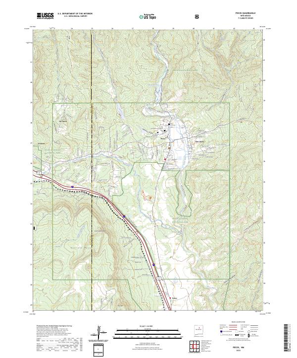
2023 Map of Pecos
USGS Topo · Published 2023About this map
The Pecos River valley serves as the central corridor for this high-elevation landscape, where the settlements of Pecos and East Pecos are established near the confluence of Glorieta Creek. This modern survey details the significant cultural and archaeological footprint of the region, anchored by the Pecos National Historical Park and the Ruins Trl. The proximity of the Old Saint Anthony's Cem and the Saint Anthony's Catholic Church Cem to the town center reflects the long-standing community roots in this part of the Sangre de Cristo foothills.
Find a feature on this map
88 named features on this map. Tap any name to fly to it.
Don’t see what you’re looking for? This feature index may not catch every label — zoom into the map to look around manually.
Map Details
Editions of this 2023 Pecos Map
This is the sole edition of this map. No revisions or reprints were ever made.
Other maps of this area

1889 · Santa Fe
USGS Topo · 1:125,000

1894 · Santa Fe
USGS Topo · 1:125,000

1894 · Lamy
USGS Topo · 1:125,000

1953 · Glorieta
USGS Topo · 1:24,000

1953 · Mc Clure Reservoir
USGS Topo · 1:24,000

1954 · Santa Fe
USGS Topo · 1:250,000

1958 · Santa Fe
USGS Topo · 1:250,000

1961 · Honey Boy Ranch
USGS Topo · 1:24,000

1961 · Rosilla Peak
USGS Topo · 1:24,000
1961 · Pecos
USGS Topo · 1:24,000