
1971 Map of Pedarosa Camp
USGS Topo · Published 1974About this map
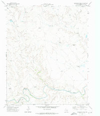
Pedarosa Camp serves as a central landmark in this 1971 survey of Hartley County, where the High Plains landscape is defined by its vital water infrastructure. The map meticulously records a network of windmills essential for cattle ranching, including the Full Blood Windmill, Soda Windmill, and Sinclair Windmill. These features, along with names like Banks Windmill and Trujillo Windmill, reflect the localized management of the range during the early 1970s.
Find a feature on this map
29 named features on this map. Tap any name to fly to it.
Don’t see what you’re looking for? This feature index may not catch every label — zoom into the map to look around manually.
Map Details
Editions of this 1971 Pedarosa Camp Map
This is the sole edition of this map. No revisions or reprints were ever made.
Other maps of this area

1954 · Tucumcari
USGS Topo · 1:250,000

1958 · Tucumcari
USGS Topo · 1:250,000

1971 · Middle Water
USGS Topo · 1:24,000

1971 · Romero SE
USGS Topo · 1:24,000

1971 · Proctor Ranch
USGS Topo · 1:24,000

1971 · Spring Creek Ranch
USGS Topo · 1:24,000

1971 · Many Post Camp
USGS Topo · 1:24,000
1971 · Humdinger Spring
USGS Topo · 1:24,000

1973 · King SW
USGS Topo · 1:24,000
1973 · King SE
USGS Topo · 1:24,000