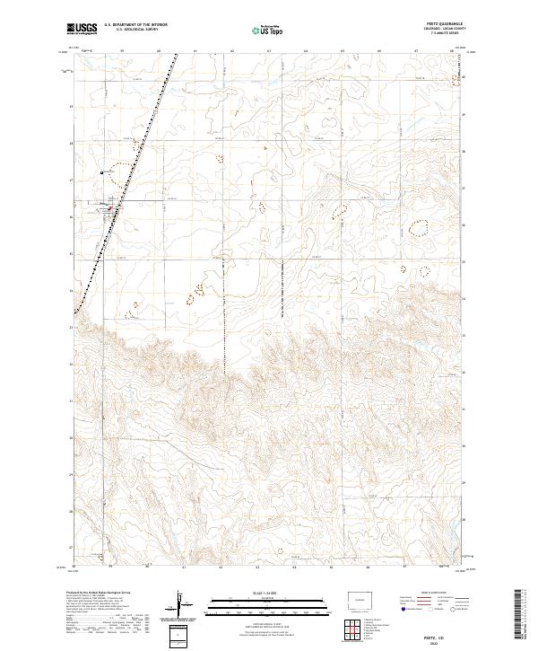
2022 Map of Peetz
USGS Topo · Published 2022About this map
Peetz serves as the primary settlement hub for this agricultural landscape in northeastern Logan County. The town site is defined by a grid featuring Main St, North St, and Louisa ST, which supports the local farming community near the Nebraska border. Just northwest of the town center lies the Peetz Cem, a key landmark for genealogical research in this rural district. The surrounding terrain is shaped by an intricate network of drainage systems, including Cow Cr and Cottonwood Cr, which carve through the high plains topography. Notably, the North Sterling Outlet Canal occupies the southeastern corner of the map, representing a significant piece of regional water management infrastructure used for irrigation in this arid section of Colorado.
Find a feature on this map
25 named features on this map. Tap any name to fly to it.
Don’t see what you’re looking for? This feature index may not catch every label — zoom into the map to look around manually.
Map Details
Editions of this 2022 Peetz Map
This is the sole edition of this map. No revisions or reprints were ever made.
Other maps of this area

1899 · Sidney
USGS Topo · 1:125,000

1951 · Iliff
USGS Topo · 1:24,000

1951 · Padroni NW
USGS Topo · 1:24,000

1952 · Padroni
USGS Topo · 1:24,000

1953 · Peetz
USGS Topo · 1:24,000

1953 · Proctor
USGS Topo · 1:24,000

1953 · Haystack Butte
USGS Topo · 1:24,000

1954 · Sterling
USGS Topo · 1:250,000

1954 · Scottsbluff
USGS Topo · 1:250,000

1958 · Scottsbluff
USGS Topo · 1:250,000