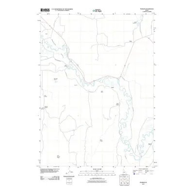
2010 Map of Pegram
USGS Topo · Published 2010About this map
The Bear River meanders through this southeast Idaho landscape, defining the character of the valley between the high ground of Dairy Ridge and Pine Spring Ridge. In this 2010 survey, the importance of water management is evident through a complex network of irrigation infrastructure including the Montpelier Preston Canal, Black Otter Canal, and Nuffer Canal. These systems support the agricultural settlements of Dingle, Alton, and Pegram, which are positioned along the primary transit corridors of Old Hwy 30 and Pegram Rd.
Find a feature on this map
33 named features on this map. Tap any name to fly to it.
Don’t see what you’re looking for? This feature index may not catch every label — zoom into the map to look around manually.
Map Details
Editions of this 2010 Pegram Map
This is the sole edition of this map. No revisions or reprints were ever made.
Other maps of this area

1909 · Montpelier
USGS Topo · 1:125,000

1911 · Montpelier
USGS Topo · 1:125,000

1955 · Preston
USGS Topo · 1:250,000

1958 · Preston
USGS Topo · 1:250,000

1962 · Preston
USGS Topo · 1:250,000

1967 · Montpelier
USGS Topo · 1:24,000

1967 · Dingle
USGS Topo · 1:24,000
1970 · Border
USGS Topo · 1:24,000
1970 · Bear Lake North
USGS Topo · 1:24,000
1970 · Boundary Ridge
USGS Topo · 1:24,000