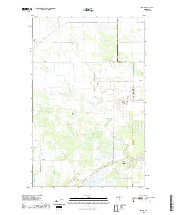
2022 Map of Pelan
USGS Topo · Published 2022About this map
Pelan Pioneer Cemetery sits at the intersection of a landscape defined by organized drainage and the natural meandering of the South Branch Two Rivers. Located along the border of Kittson and Roseau counties, this territory reflects a heavily managed hydraulic environment. An extensive network of artificial waterways, including Lateral Ditch Number One, Lateral Ditch Number Two, and State Ditch Number Ninetyfive, overlays the native wetlands and prairies of Northwest Minnesota. These ditches represent the long-term engineering efforts to make this low-lying region suitable for agriculture. To the south, the Twin Lakes remain a significant natural feature amidst the grid of section lines and gravel roads like Co RD 7. The map illustrates a sparse, rural settlement pattern where early history is preserved primarily through the names of family homesteads and the resting places of original pioneers.
Find a feature on this map
26 named features on this map. Tap any name to fly to it.
Don’t see what you’re looking for? This feature index may not catch every label — zoom into the map to look around manually.
Map Details
Editions of this 2022 Pelan Map
This is the sole edition of this map. No revisions or reprints were ever made.
Other maps of this area

1918 · Hemmington
USGS Topo · 1:62,500

1919 · Pelan
USGS Topo · 1:62,500

1930 · Juneberry
USGS Topo · 1:31,680

1932 · Juneberry
USGS Topo · 1:62,500

1952 · Thief River Falls
USGS Topo · 1:250,000

1956 · Thief River Falls
USGS Topo · 1:250,000

1956 · Karlstad
USGS Topo · 1:62,500

1957 · Thief River Falls
USGS Topo · 1:250,000

1957 · Pelan
USGS Topo · 1:62,500

1966 · Skull Lake SE
USGS Topo · 1:24,000