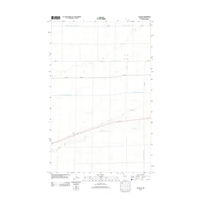
2013 Map of Pelan NE
USGS Topo · Published 2013About this map
S Br Two Rivers meanders through this portion of Roseau County, a landscape defined by an extensive network of water management projects. The map documents the engineering of the regional hydrology, where straight-cut channels like State Ditch Number Ninetyfive and several numbered laterals, including Lateral Ditch Number One and Lateral Ditch Number Two, cut across the section lines to manage the low-lying terrain. Human presence is concentrated primarily along the MN-11 corridor, which serves as the primary east-west artery through this rural expanse. For those researching local history, the Pauli Cem stands as a significant landmark along this highway, representing the early settlement roots in this quiet corner of northern Minnesota. The grid of section roads like 210th St and 170th Ave further illustrates the systematic agricultural partitioning of the land in the early twenty-first century.
Find a feature on this map
14 named features on this map. Tap any name to fly to it.
Don’t see what you’re looking for? This feature index may not catch every label — zoom into the map to look around manually.
Map Details
Editions of this 2013 Pelan NE Map
This is the sole edition of this map. No revisions or reprints were ever made.
Other maps of this area

1918 · Greenbush
USGS Topo · 1:62,500

1919 · Pelan
USGS Topo · 1:62,500

1919 · Badger
USGS Topo · 1:62,500

1930 · Juneberry
USGS Topo · 1:31,680

1932 · Juneberry
USGS Topo · 1:62,500

1952 · Thief River Falls
USGS Topo · 1:250,000

1956 · Thief River Falls
USGS Topo · 1:250,000

1957 · Thief River Falls
USGS Topo · 1:250,000

1957 · Pelan
USGS Topo · 1:62,500

1962 · Strathcona
USGS Topo · 1:24,000