
1962 Map of Strathcona
USGS Topo · Published 1964About this map
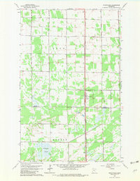
Strathcona sits at the center of this topographic study, serving as a hub for the surrounding agricultural landscape of northwest Minnesota. The Great Northern railroad provides the primary north-south corridor, bisecting the townships of Deer and Huntly while connecting the town to the broader regional economy. The map illustrates a community shaped by its rural institutions, with the Poplar Grove Ch and a local Townhall serving as focal points for the scattered farmsteads.
Find a feature on this map
14 named features on this map. Tap any name to fly to it.
Don’t see what you’re looking for? This feature index may not catch every label — zoom into the map to look around manually.
Map Details
Editions of this 1962 Strathcona Map
2 editions found
Other maps of this area

1918 · Greenbush
USGS Topo · 1:62,500

1918 · Middle River
USGS Topo · 1:62,500

1919 · Pelan
USGS Topo · 1:62,500

1952 · Thief River Falls
USGS Topo · 1:250,000

1956 · Thief River Falls
USGS Topo · 1:250,000

1957 · Thief River Falls
USGS Topo · 1:250,000

1957 · Newfolden
USGS Topo · 1:62,500

1957 · Pelan
USGS Topo · 1:62,500
1961 · Middle River NE
USGS Topo · 1:24,000
1962 · Middle River
USGS Topo · 1:24,000