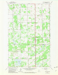
1962 Map of Strathcona
USGS Topo · Published 1982About this map
Strathcona serves as the central hub of this northern Minnesota landscape, situated where the Great Northern railroad cuts a straight north-south line through the townships of Deer and Huntly. The map documents a rural community anchored by small-scale civic and religious institutions, such as the Townhall and Poplar Grove Ch east of the tracks. The boundary between Roseau and Marshall counties bisects the region, reflecting the administrative divisions of these prairie farmsteads in the early 1960s.
Find a feature on this map
16 named features on this map. Tap any name to fly to it.
Don’t see what you’re looking for? This feature index may not catch every label — zoom into the map to look around manually.
Map Details
Editions of this 1962 Strathcona Map
2 editions found
Other maps of this area

1918 · Greenbush
USGS Topo · 1:62,500

1918 · Middle River
USGS Topo · 1:62,500

1919 · Pelan
USGS Topo · 1:62,500

1952 · Thief River Falls
USGS Topo · 1:250,000

1956 · Thief River Falls
USGS Topo · 1:250,000

1957 · Thief River Falls
USGS Topo · 1:250,000

1957 · Newfolden
USGS Topo · 1:62,500

1957 · Pelan
USGS Topo · 1:62,500
1961 · Middle River NE
USGS Topo · 1:24,000

1962 · Strathcona
USGS Topo · 1:24,000