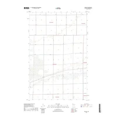
2019 Map of Pelan NE
USGS Topo · Published 2019About this map
Hydrological engineering defines this portion of Roseau County, where a complex network of man-made waterways like Lateral Ditch Number One and State Ditch Number Ninetyfive manages the low-lying terrain. These channels cut across the township lines of t160n r44w and t161n r44w, illustrating the massive effort required to drain the wetlands for agricultural use. Amidst this geometric grid of roads and ditches, the natural meandering path of the S Br Two Rivers provides a stark contrast to the straight-line precision of Lateral Ditch Number Two. Local heritage is anchored by Pauli Cem, a quiet landmark situated near the southern bends of the river branch. The landscape is also traversed by specialized paths such as the Ve Trl and Ve Rte, which follow the section lines and drainage corridors common to this northern Minnesota borderland.
Find a feature on this map
28 named features on this map. Tap any name to fly to it.
Don’t see what you’re looking for? This feature index may not catch every label — zoom into the map to look around manually.
Map Details
Editions of this 2019 Pelan NE Map
This is the sole edition of this map. No revisions or reprints were ever made.
Other maps of this area

1918 · Greenbush
USGS Topo · 1:62,500

1919 · Pelan
USGS Topo · 1:62,500

1919 · Badger
USGS Topo · 1:62,500

1930 · Juneberry
USGS Topo · 1:31,680

1932 · Juneberry
USGS Topo · 1:62,500

1952 · Thief River Falls
USGS Topo · 1:250,000

1956 · Thief River Falls
USGS Topo · 1:250,000

1957 · Thief River Falls
USGS Topo · 1:250,000

1957 · Pelan
USGS Topo · 1:62,500

1962 · Strathcona
USGS Topo · 1:24,000