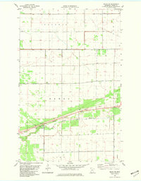
1982 Map of Pelan NE
USGS Topo · Published 1982About this map
The South Branch Two Rivers and Two Rivers Branch define the water-rich landscape of Roseau County, where natural drainage is heavily supplemented by an engineered network including State Ditch No 95 and Lateral Ditch No 1. This 1982 survey illustrates a region defined by township boundaries like Dewey, Bart O, and Polonia, where the rural infrastructure is centered around landmarks such as the Townhall and the Pelan Pioneer Chapel. Local history and recreation are centered at Pelan Pioneer Park, which includes a Campground and Picnic Area. The presence of Pauli Cem and numerous Gravel Pits along the river branches offers specific points of interest for genealogists and researchers mapping the 20th-century utilization of the Minnesota prairie and its waterway management.
Find a feature on this map
20 named features on this map. Tap any name to fly to it.
Don’t see what you’re looking for? This feature index may not catch every label — zoom into the map to look around manually.
Map Details
Editions of this 1982 Pelan NE Map
This is the sole edition of this map. No revisions or reprints were ever made.
Other maps of this area

1918 · Greenbush
USGS Topo · 1:62,500

1919 · Pelan
USGS Topo · 1:62,500

1919 · Badger
USGS Topo · 1:62,500

1930 · Juneberry
USGS Topo · 1:31,680

1932 · Juneberry
USGS Topo · 1:62,500

1952 · Thief River Falls
USGS Topo · 1:250,000

1956 · Thief River Falls
USGS Topo · 1:250,000

1957 · Thief River Falls
USGS Topo · 1:250,000

1957 · Pelan
USGS Topo · 1:62,500

1962 · Strathcona
USGS Topo · 1:24,000