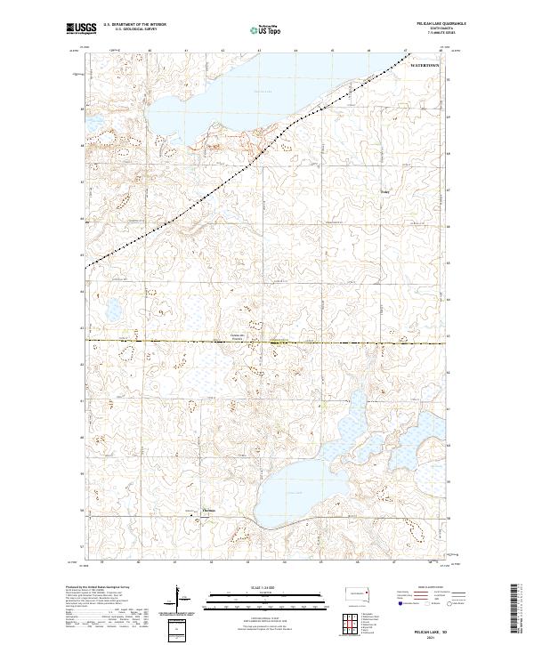
2021 Map of Pelican Lake
USGS Topo · Published 2021About this map
Pelican Lake and the surrounding glacial highlands of the Coteau des Prairies dominate this portion of eastern South Dakota. This 2021 survey illustrates the rural landscape between the southwestern edge of Watertown and the smaller settlements of Foley and Thomas. The map records a transition from residential developments near the lake's eastern shore, such as those along Air Haven Rd, to the more traditional section-line road network defining the agricultural interior.
Find a feature on this map
41 named features on this map. Tap any name to fly to it.
Don’t see what you’re looking for? This feature index may not catch every label — zoom into the map to look around manually.
Map Details
Editions of this 2021 Pelican Lake Map
This is the sole edition of this map. No revisions or reprints were ever made.
Other maps of this area

1953 · Watertown
USGS Topo · 1:250,000

1958 · Watertown
USGS Topo · 1:250,000

1969 · Hayti
USGS Topo · 1:24,000

1969 · Castlewood
USGS Topo · 1:24,000

1969 · Watertown West
USGS Topo · 1:24,000

1969 · Pelican Lake
USGS Topo · 1:24,000

1969 · Watertown SE
USGS Topo · 1:24,000

1969 · Watertown East
USGS Topo · 1:24,000

1973 · Bryant NE
USGS Topo · 1:24,000
1973 · Kampeska
USGS Topo · 1:24,000