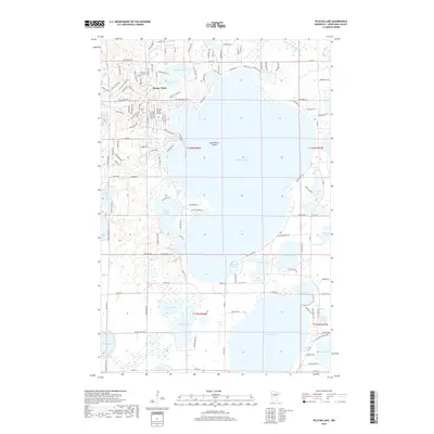
2019 Map of Pelican Lake
USGS Topo · Published 2019About this map
Pelican Lake dominates this Crow Wing County landscape, centered around the lakeside community of Breezy Point. The settlement is a hub of recreational and residential development, evidenced by the dense network of roads like Sunset Valley Rd and Lakeview Ln that ring the water's edge. The northern shore is marked by the presence of the Breezy Point Airport, providing a distinctive transportation link for this vacation and residential destination.
Find a feature on this map
134 named features on this map. Tap any name to fly to it.
Don’t see what you’re looking for? This feature index may not catch every label — zoom into the map to look around manually.
Map Details
Editions of this 2019 Pelican Lake Map
This is the sole edition of this map. No revisions or reprints were ever made.
Other maps of this area

1915 · Brainerd
USGS Topo · 1:62,500

1916 · Pillager
USGS Topo · 1:62,500

1918 · Brainerd
USGS Topo · 1:62,500

1919 · Pillager
USGS Topo · 1:62,500

1953 · Brainerd
USGS Topo · 1:250,000

1957 · Brainerd
USGS Topo · 1:250,000

1958 · Brainerd
USGS Topo · 1:250,000

1959 · Trommald
USGS Topo · 1:24,000

1959 · Pelican Lake
USGS Topo · 1:24,000

1959 · Nisswa
USGS Topo · 1:24,000