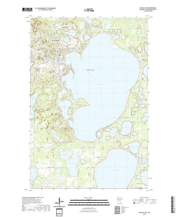
2022 Map of Pelican Lake
USGS Topo · Published 2022About this map
Breezy Point serves as the primary hub of this lake-strewn landscape in Crow Wing County, defined by the sprawling waters of Pelican Lake. The settlement patterns here are deeply tied to the shorelines, with residential road networks like Breezy Point Dr and Pelican Lake Rd winding around countless glacial basins. The area’s character as a destination for seasonal and year-round lakeside living is underscored by the presence of the Breezy Point Airport and the complex of smaller water bodies such as Lougee Lake, Markee Lake, and Little Pelican Lake. Further south, the map reveals a more open, wetland-heavy terrain around Garden Lake and Johnson Lake, showing the natural drainage patterns that feed into Pelican Brook. This survey provides a contemporary record of the developed northern woods, where recreational geography and local infrastructure intersect.
Find a feature on this map
141 named features on this map. Tap any name to fly to it.
Don’t see what you’re looking for? This feature index may not catch every label — zoom into the map to look around manually.
Map Details
Editions of this 2022 Pelican Lake Map
This is the sole edition of this map. No revisions or reprints were ever made.
Other maps of this area

1915 · Brainerd
USGS Topo · 1:62,500

1916 · Pillager
USGS Topo · 1:62,500

1918 · Brainerd
USGS Topo · 1:62,500

1919 · Pillager
USGS Topo · 1:62,500

1953 · Brainerd
USGS Topo · 1:250,000

1957 · Brainerd
USGS Topo · 1:250,000

1958 · Brainerd
USGS Topo · 1:250,000

1959 · Trommald
USGS Topo · 1:24,000

1959 · Pelican Lake
USGS Topo · 1:24,000

1959 · Nisswa
USGS Topo · 1:24,000