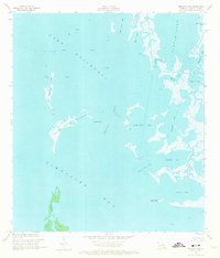
1956 Map of Pelican Pass
USGS Topo · Published 1973About this map
Lake Raccourci and the surrounding marshlands of Lafourche Parish define this mid-century coastal landscape, dominated by an active Oil Field infrastructure. The map reveals an intricate network of waterways including Timbalier Bay, Little Lake, and the curiously named Wrong Name Pass. This era represents a period of significant industrial activity in the wetlands, evidenced by numerous Gas Wells and Oil Wells scattered across the open water and marsh.
Find a feature on this map
28 named features on this map. Tap any name to fly to it.
Don’t see what you’re looking for? This feature index may not catch every label — zoom into the map to look around manually.
Map Details
Editions of this 1956 Pelican Pass Map
4 editions found
Other maps of this area

1892 · Cheniere Caminada
USGS Topo · 1:62,500

1892 · Creole
USGS Topo · 1:62,500

1894 · Timbalier
USGS Topo · 1:62,500

1894 · Lake Felicity
USGS Topo · 1:62,500

1935 · Timbalier Island
USGS Topo · 1:31,680

1935 · Bay Courant
USGS Topo · 1:31,680

1935 · Pelican Pass
USGS Topo · 1:31,680

1935 · Mink Bayou
USGS Topo · 1:31,680

1935 · Calumet Island
USGS Topo · 1:31,680

1935 · Leeville
USGS Topo · 1:31,680