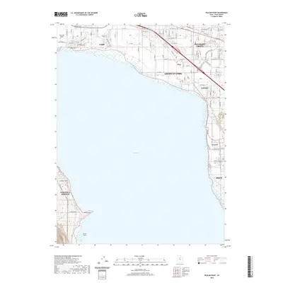
2020 Map of Pelican Point
USGS Topo · Published 2020About this map
Utah Lake dominates the central landscape of this 2020 quadrangle, serving as the focal point for several growing communities along its northern and eastern shores. To the north, the urban corridor of Lehi, American Fork, and Pleasant Grove shows an intricate network of modern infrastructure and residential expansion. The map documents the hydraulic history of the region through features like the McArthur Ditch and the Lake Shore Canal, which trace the efforts to manage water in this arid valley.
Find a feature on this map
61 named features on this map. Tap any name to fly to it.
Don’t see what you’re looking for? This feature index may not catch every label — zoom into the map to look around manually.
Map Details
Editions of this 2020 Pelican Point Map
This is the sole edition of this map. No revisions or reprints were ever made.
Other maps of this area

1885 · Salt Lake
USGS Topo · 1:250,000

1948 · Timpanogos Cave
USGS Topo · 1:24,000

1948 · Orem
USGS Topo · 1:24,000

1948 · Orem
USGS Topo · 1:62,500

1948 · Provo
USGS Topo · 1:24,000

1949 · Provo
USGS Topo · 1:62,500

1950 · Orem
USGS Topo · 1:24,000

1950 · Timpanogos Cave
USGS Topo · 1:24,000

1950 · Provo
USGS Topo · 1:24,000
1950 · Soldiers Pass
USGS Topo · 1:24,000